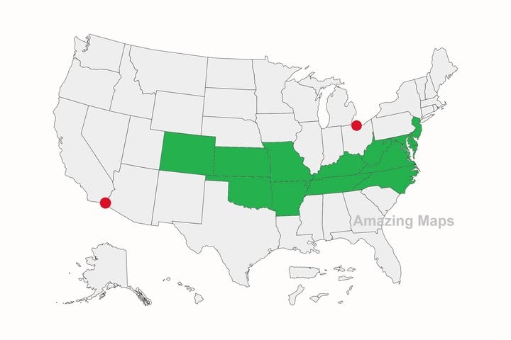
Interesting map
ArishMell · 70-79, M
It can be surprising to find where your home is, relative to others'.
I live in Southern England, where we think it's cold if a Winter frost drops below -5ºC; yet I am very slightly North of Newfoundland where such temperatures are probably thought very mild. It does become colder in Scotland, but that is about level with the large bay in the corner of Hudson Bay.
Which is the further West: London or Edinburgh?
A common map convention stands the British Isles upright like a big capital 'L', suggesting the two capitals are more or less on the Greenwich Meridian; but the landmass actually "leans" over towards the West.
All of Scotland and the Northern half of England are West of London (0ºW or E).
Western Scotland and Land's End are more than 5ºW. Glasgow and Plymouth are at roughly 4º 20' W - so their noon and midnight are nearly 14 minutes later than the GMT ones! This only started to be a problem with the development of the railways requiring standard time-tables. Previously a properly set sundial was the most accurate though low-definition time-keeper, and referenced to local noon.
That is on a relatively compact area only a few hundred miles wide. Start similar exercises on continents and the results are even larger.
View 1 more replies »
ArishMell · 70-79, M
@JimboSaturn Not that close. Skye is off the West coast but even the Shetlands, to the North, are still more tnan 10º in latitude South of the Arctic Circle. They are on the pretty much the same latitude as Bergen, the very Southern tip of Greenland and the middle of Hudson Bay.
All well South of Iceland, whose North coast only just touches the Arctic Circle..
Their climate is a lot milder than those though, with strong winds and rain more than snow and deep cold in Winter.
All well South of Iceland, whose North coast only just touches the Arctic Circle..
Their climate is a lot milder than those though, with strong winds and rain more than snow and deep cold in Winter.
JimboSaturn · 56-60, M
@ArishMell When I visited the Taliskers distillery, they said it was close lol
ArishMell · 70-79, M
@JimboSaturn Well, it's closer than England is! :-)
bijouxbroussard · F
California is one of those states that used to be part of Mexico. I have a friend whose ancestors lived here when it was.
Still, she once received a nasty letter in her mailbox telling to "go back" where she "came from". 😳
Still, she once received a nasty letter in her mailbox telling to "go back" where she "came from". 😳
Nick1 · 61-69, M
@bijouxbroussard Those are the people whose history lessons came from internet influencers only lol
JimboSaturn · 56-60, M
A lot of Americans don't know that they can quite easily more north than I am lince I live in Toronto. Also a large amount of Canadians live more south than Americans.
DunningKruger · 61-69, M
Missouri. Grrr.... We miss out on everything.
redredred · M
Alaska is the Westernmost, northernmost and actually the easternmost US state. Since a few of the Aleutian Islands cross the international dateline they are east of the rest of the US. Hawaii is the southernmost state.
swirlie · 31-35
Well, that's good. It will make it easier for Canada to annex the USA and call it our 11 Province then. Trust me, you'll get use to Canadian money!


