Random
Only logged in members can reply and interact with the post.
Join SimilarWorlds for FREE »

Interesting map

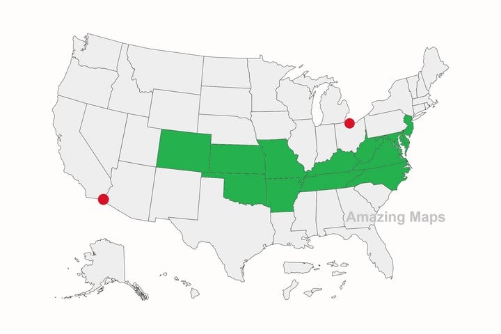
The two red dots are the southernmost point in Canada and the northernmost point in Mexico. And so, of all the U.S. states, only the ones in green are entirely north of Mexico and south of Canada!

This page is a permanent link to the reply below and its nested replies. See all post replies »
Well, that's good. It will make it easier for Canada to annex the USA and call it our 11 Province then. Trust me, you'll get use to Canadian money!
ArishMell · 70-79, M
@swirlie ....used to ... and SI units?