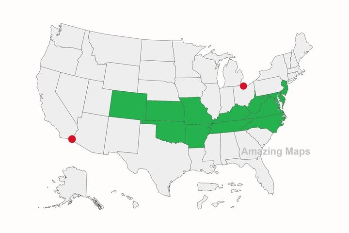
The two red dots are the southernmost point in Canada and the northernmost point in Mexico. And so, of all the U.S. states, only the ones in green are entirely north of Mexico and south of Canada!
This page is a permanent link to the reply below and its nested replies. See all post replies »
California is one of those states that used to be part of Mexico. I have a friend whose ancestors lived here when it was. Still, she once received a nasty letter in her mailbox telling to "go back" where she "came from". 😳