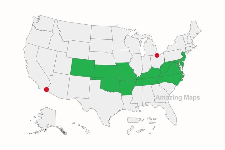
The two red dots are the southernmost point in Canada and the northernmost point in Mexico. And so, of all the U.S. states, only the ones in green are entirely north of Mexico and south of Canada!
This page is a permanent link to the reply below and its nested replies. See all post replies »
A lot of Americans don't know that they can quite easily more north than I am lince I live in Toronto. Also a large amount of Canadians live more south than Americans.