


Ynotisay · M
@SooperSarah I remember that show. Really interesting.

Viper · M
@SooperSarah yup, and how Chicago was in Wisconsin territory, but Illinois needed to claim more land and people so they could file for statehood and so claimed the southern 50 miles of Wisconsin territory so they could do so.
Also not in that show (that I remember), but the line between Maryland and Pennsylvania being disputed, as the Brittain person making the state claims screwed up...
Original, Philadelphia should of been in Maryland.... but when they battled, Maryland Governor made a power play and pissed up the British guy deciding and he then gave it to Pennsylvania, when he was supposedly leaning towards Maryland, before the power play (note, Maryland didn't now he was leaning towards Maryland and feared he was leaning towards Pennsylvania, which is why they made the power play).
But some of the biggest cities, almost ended up in different states.

View 2 more replies »


Viper · M
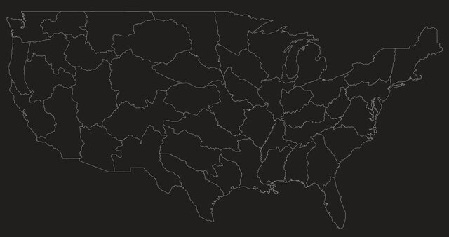
Very very interesting, I've thought states should do this for their Voting District Map, try to make it geographical and not political... But of course this political people in charge of it so it's always going to be political...
Also, I don't like it, too many odd shapes, and I think a other cool input would be time zones.
Also, I don't like it, too many odd shapes, and I think a other cool input would be time zones.

DeWayfarer · 61-69, M
Have some serious qualms with the Wyoming/Colorado area on that map.
No way is it that large. There's the Rockies immediately west of the Denver Plateau all the way up to Cheyenne.
You even have Laramie in that area. Which is separated from Cheyenne by the Laramie mountain range.
No way is it that large. There's the Rockies immediately west of the Denver Plateau all the way up to Cheyenne.
You even have Laramie in that area. Which is separated from Cheyenne by the Laramie mountain range.

daydeeo · 61-69, M
Yes, very interesting.
I've often wondered how the southernmost portion of Alabama became the panhandle of Florida. Does anyone know?
I've often wondered how the southernmost portion of Alabama became the panhandle of Florida. Does anyone know?

Dshhh · M
i think this is based on river systems
I thing we need smaller states
I thing we need smaller states

funfan · 51-55, M
That's fascinating! Never knew that.
Roundandroundwego · 61-69
They're never going to be real.

JP1119 · 36-40, M
Nice! Now name them all!